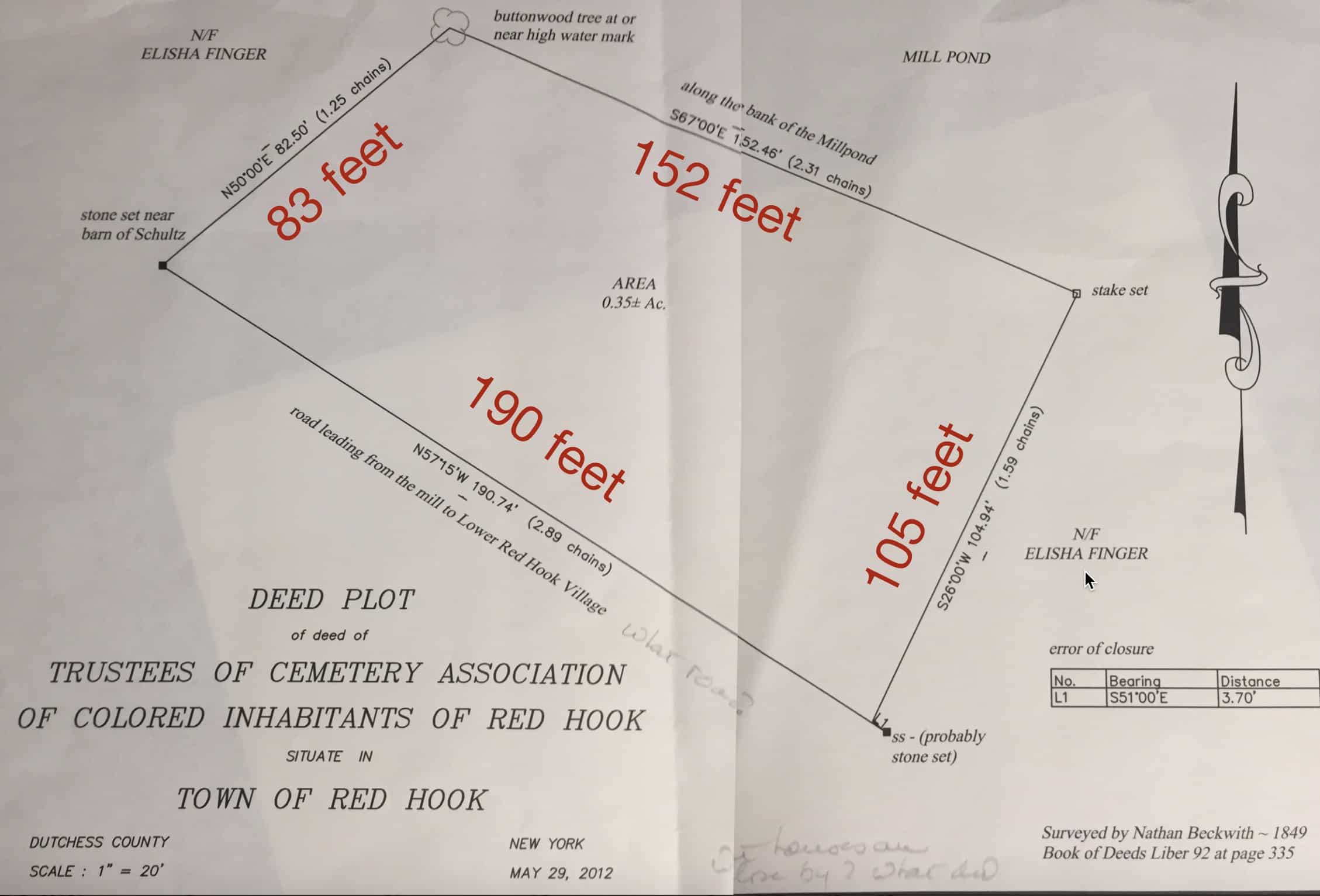
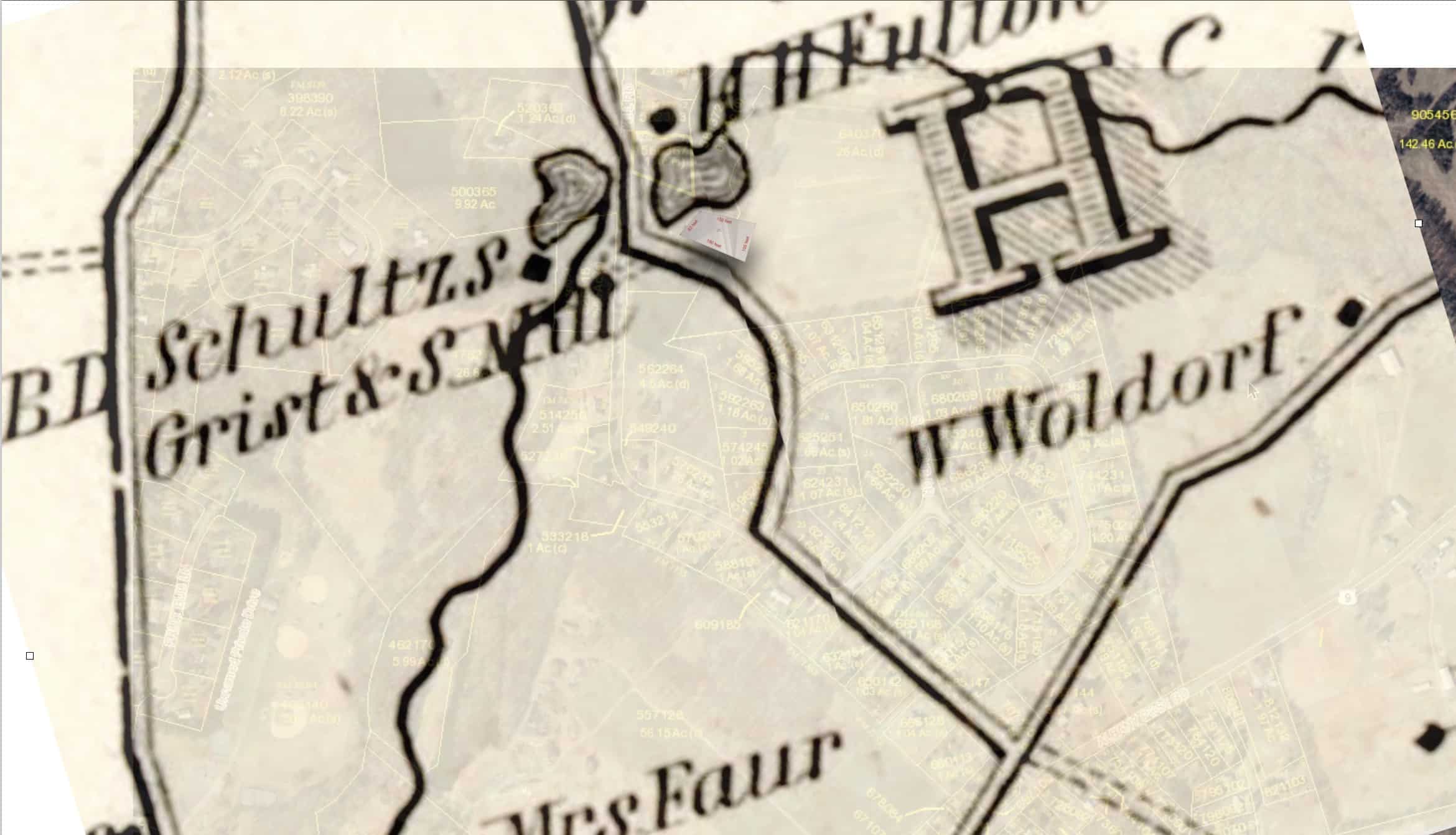
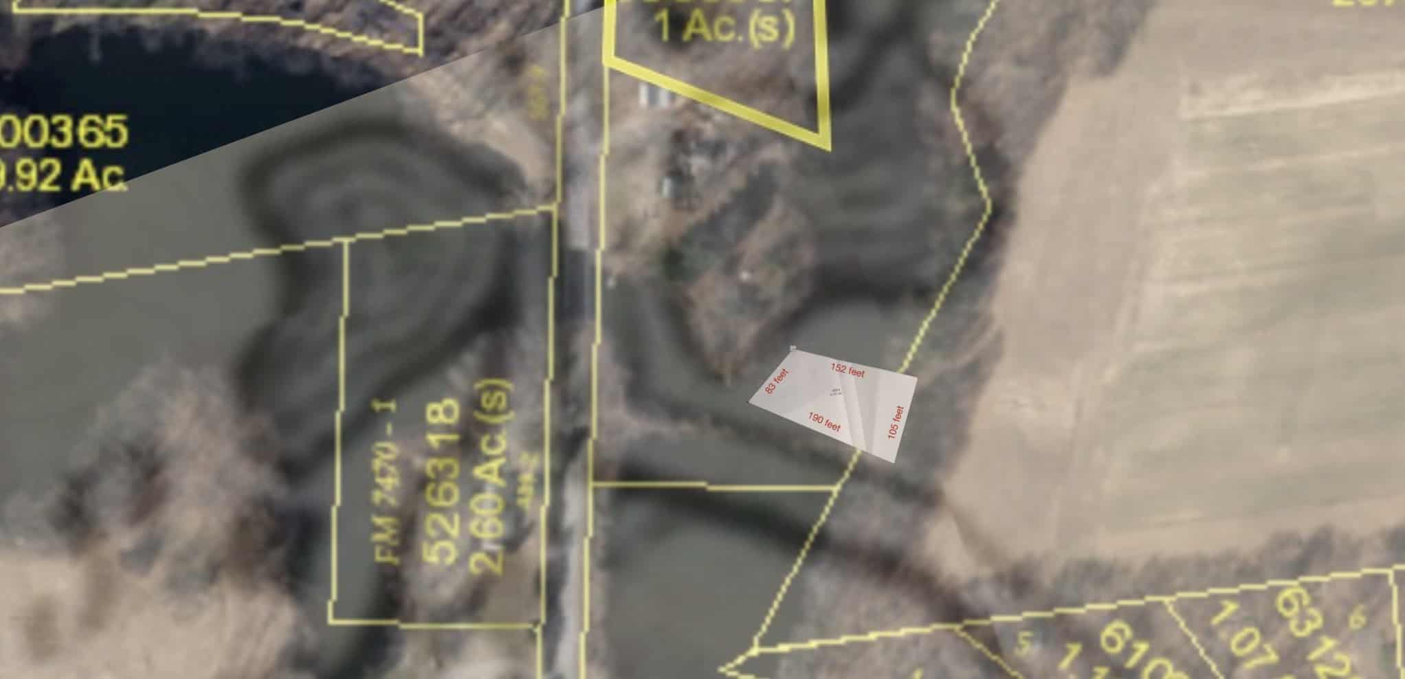
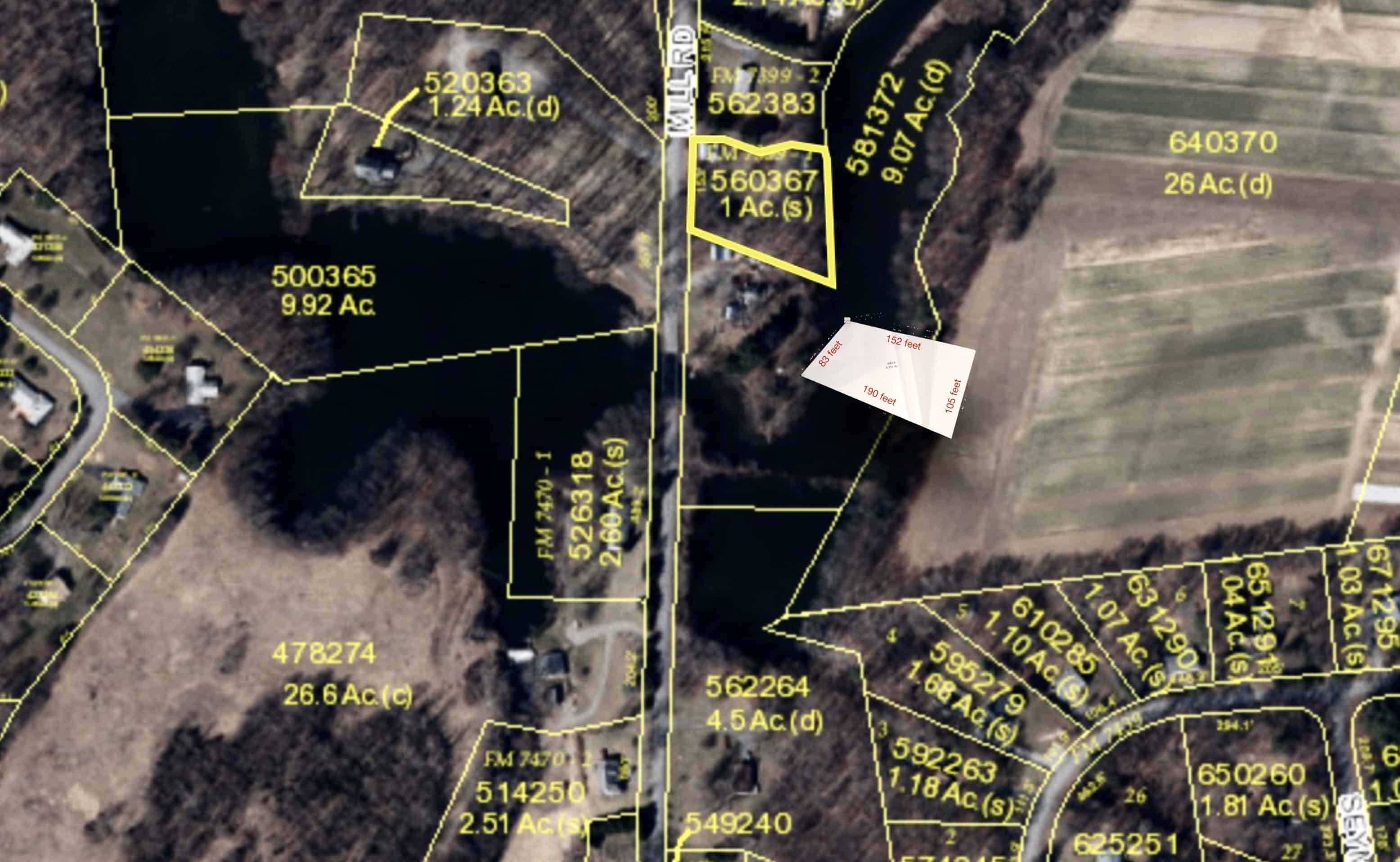
The map below (drawn 2012 based on 1849 map courtesy of Historic Red Hook) shows a 1/3rd acre plot with a road to the south and a mill pond to the north. The adjacent landowners are Schultz and Elisha Fingar. I believe due to a change in the road, and an expansion of the mill pond to the south, the former cemetery is under water on Mill Road.